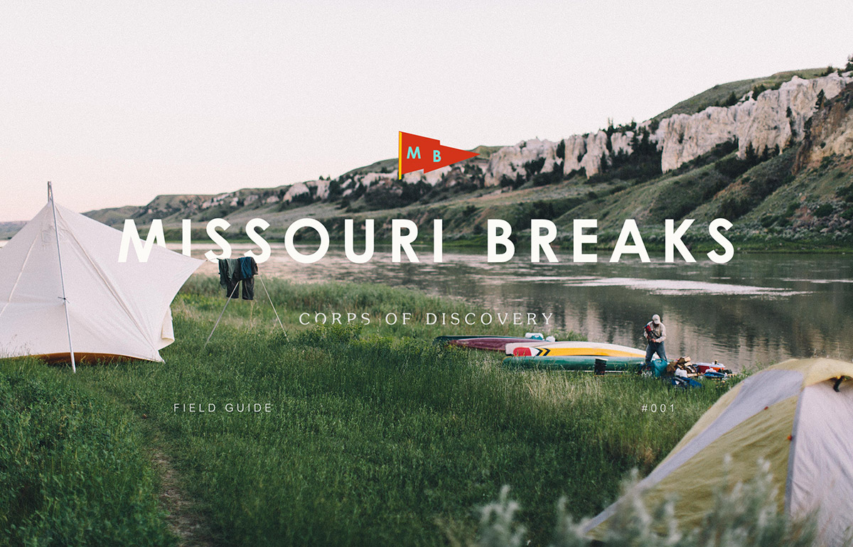
31 Aug Missouri Breaks: First Field Guide by Sanborn Canoe Co.
What sets a canoeing expedition apart is that it purifies you more rapidly and inescapably than any other. Travel a thousand miles by train and you are a brute; pedal five hundred on a bicycle and you remain basically a bourgeois; paddle a hundred in a canoe and you are already a child of nature.“
— Pierre Elliot Trudeau
In early June the team from Sanborn Canoe Co. set out to tackle a 100+ mile stretch of the Missouri River in Montana. The kind of trip that only comes together every so often. They’ve pulled everything together into their very first Field Guide. If you like epic canoe photos, good trip stories, sweeping landscapes and cool gear it’s worth your time!
Winters in Minnesota tend to be what some may call harsh. We from the North prefer to think of it as character shaping. Regardless, a canoeist finds those cold, dark months best spent dreaming of the warmer days ahead; hunching over maps, plotting courses, touching up trusty old paddles with new coats of varnish. Each spring and summer the folks at Sanborn Canoe Co. typically head north from our home in Winona, MN to paddle the lakes of the Boundary Waters Canoe Area Wilderness. However, this year we decided to mix it up. An invitation from a friend, a red-bearded Montanan, brought us to the Missouri River Breaks National Monument in Montana.
There have been a lot of exciting things happening around Sanborn this year. It’s been a bit like riding a runaway locomotive. We’re just catching glimpses of things hurtling past. Things are growing and changing; new gear, new home, new friends. In the midst of this, it’s important to remember why we set out on this journey in the first place. We began with a single minded love of canoeing and all that comes with it: knifing across glassy lakes, crackling campfires, blub-blubbing of coffee percolating, drifting quietly over secret fishing spots packed with trout, scouting new holes and haunts. With this in mind, our winter musings this year were focused on Montana.
When I first met our guide he told me, “In Montana, history is close at hand.” It was repeated often throughout our journey 100 miles down the Missouri River. Despite the way most people see Montana, at high speed through a window frame, you can’t really experience it without pausing and slowing down. Time flies but history does not.
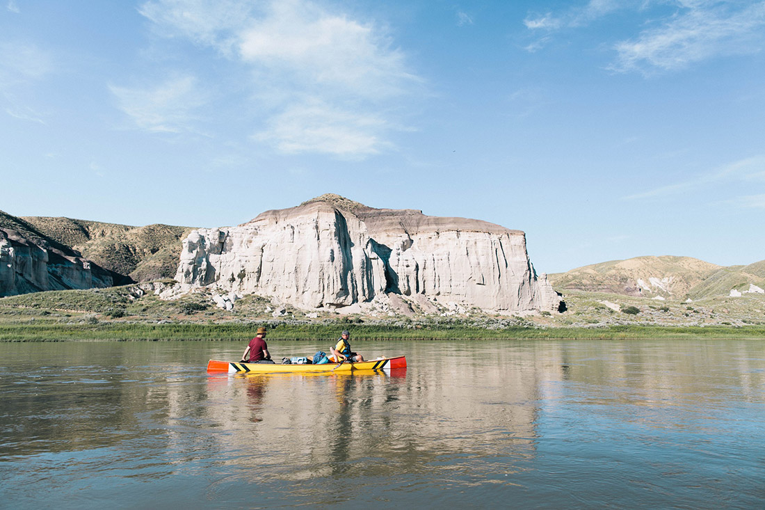
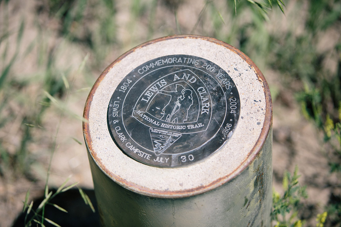
In 1805, Lewis and Clark and their Corps of Discovery were making their way up the Missouri River on their way to the Pacific Ocean. In June of that year, they passed through a stunning stretch of river running between modern day Fort Benton and the James Kipp Recreation Area, known today as the Missouri River Breaks. We retraced this route over 200 years later. Lewis described a particularly beautiful part of the Breaks like this: „I should have thought that nature had attempted here to rival the human art of masonry had I not recollected that she had first began her work.“
Our own corps of discovery travelled through the same stretch of river and found the marvels of nature are no less stunning today than when Lewis observed them all that time ago. Every bend of the river revealed a new gallery of wonderful and grotesque creations. Rusty black volcanic spires and white, sandstone cliffs tower hundreds of feet above the water. Weather worn sculptures of creatures from this world and the next, each shaped by the passing of time and given form by your own imagination.
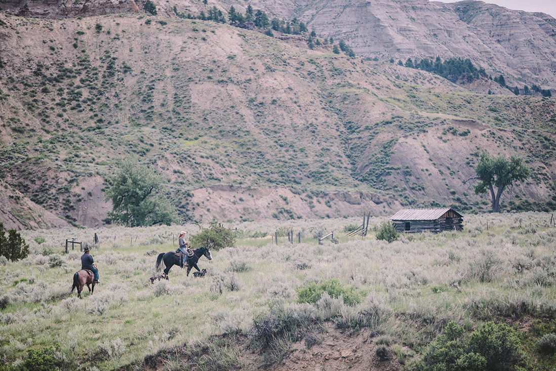
In Montana, you can see close at hand a period in American history without even going to a museum; canoe the Missouri River Breaks and you’ll see it. The shoreline is dotted with abandoned homesteads. Plots of land were once given freely to encourage families to settle the West. People came in search of wealth, adventure or simply a fresh start. Whatever brought them, the homes they built are still standing in testament to that ingrained American spirit: the need to go, to see, to make their own way and build a new life.
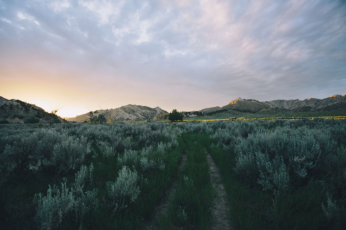
Our journey began in the Mississippi River valley of SE Minnesota. We left the bluffs and their hardwood forests in the rearview and found the terrain quickly flattening. I-94 spans the rolling farm fields of Minnesota into the flat, treeless prairies of North Dakota. Not long before the highway crosses into Montana, we found ourselves surrounded by the badlands; sandy multi-colored hills cut and carved by rainfall. Continuing westward, the topography continues to change; growing in size and scope leading up to the Rockies. In eastern and central Montana the flat, grassy cattle ranches stretch in all directions, broken by rocky outcroppings and plateaus hazy in appearance from the huge distances.
After 18 hours on the road and countless miles of sameness, descending into the Missouri River valley was like entering a new world. Green grasses and willow thickets replaced the dusty grasses and sagebrush. Cottonwood groves clump together along the banks; leaves rustling in the wind. A perfect welcome to a group of folks from Minnesota who live on the water and among the trees.
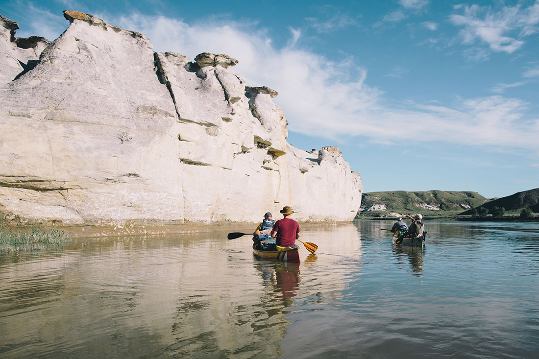
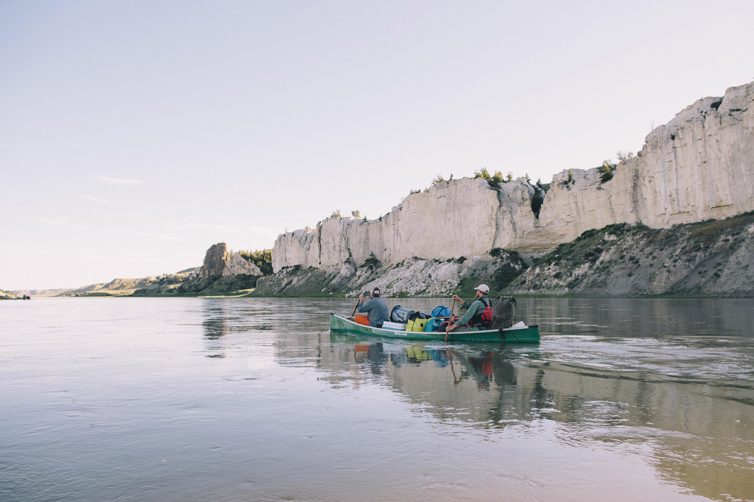
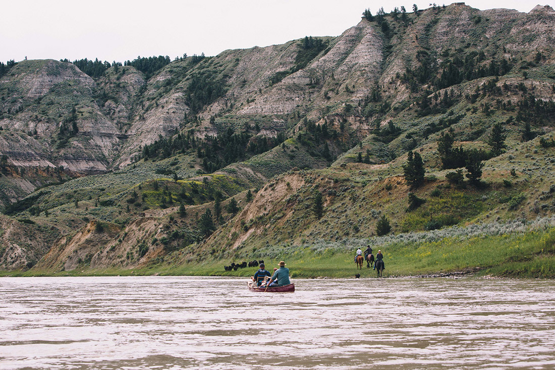
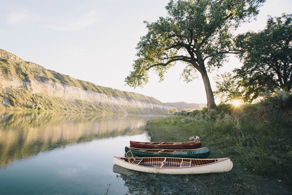
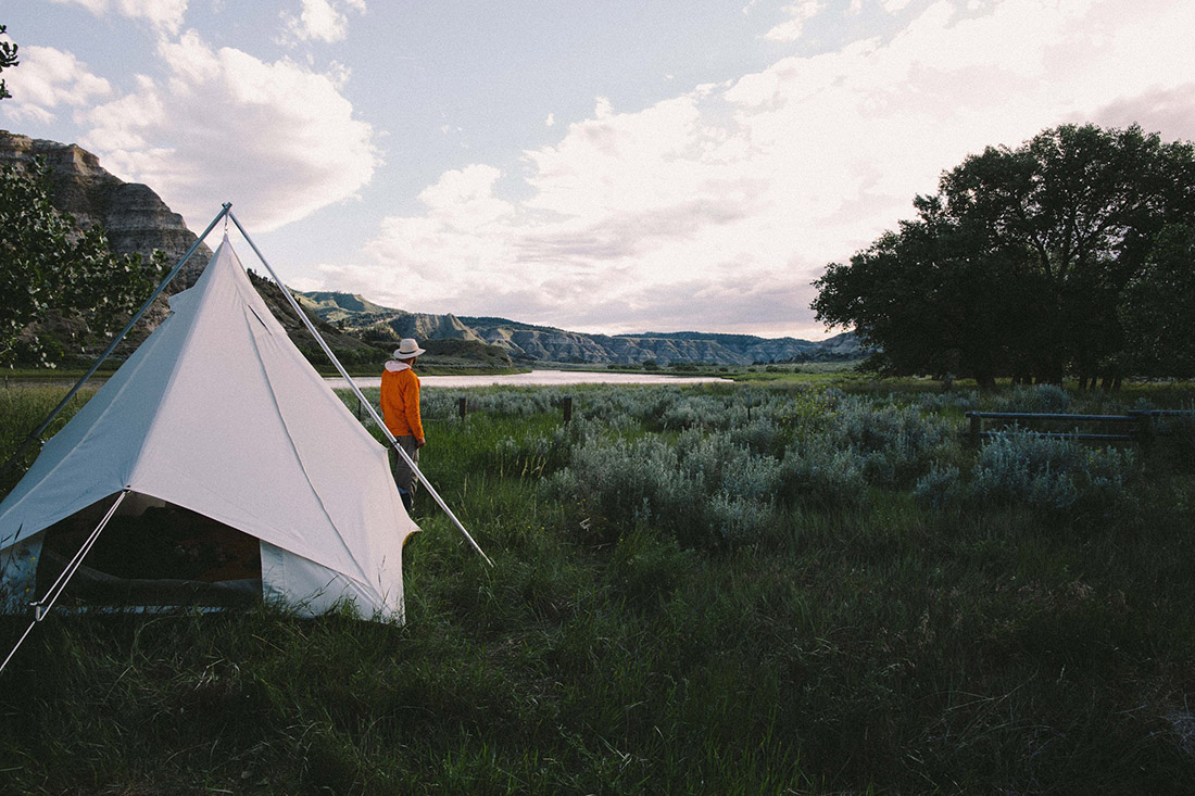
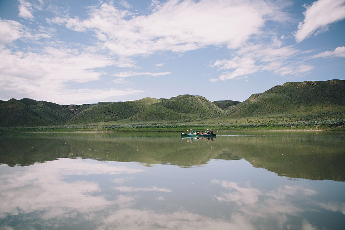
We met a local outfitter at James Kipp Recreation Area who then drove us up river to our starting point at Coal Banks Landing. Our crew of ten launched six canoes in the early afternoon. We planned to spend only an hour on the water, but finding our intended campsite full, we continued on another 10 miles downriver. This change in plans set up perhaps my favorite moment of the trip. The sun wasn’t yet setting, but evening was settling in and the light was softening. In this setting, we rounded a bend in the river and were greeted by stunning, white cliffs. In places, these cliffs descended from heights of several hundred feet directly into the water. We paddled the canoe within inches of the stone face and let our outstretched fingers brush along the rocks as we floated past. Moving with the current while touching those cliffs was an unexpectedly tangible experience of the water’s eons old work
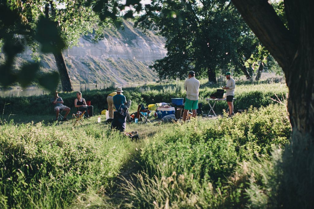
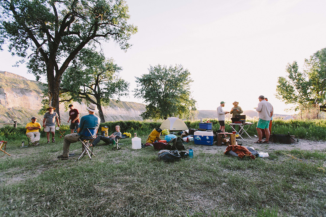
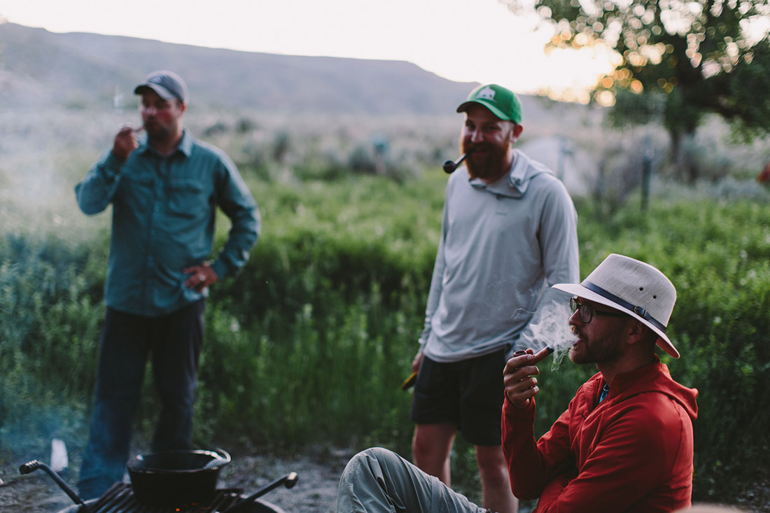
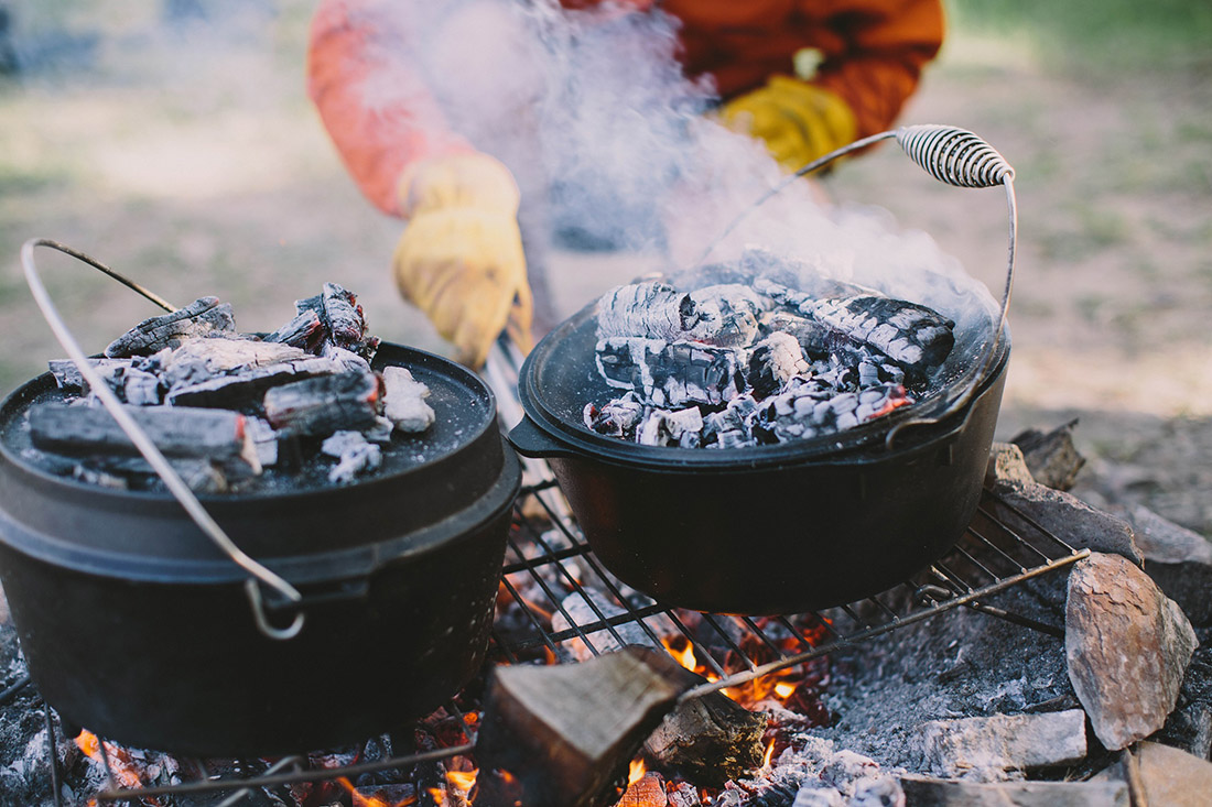
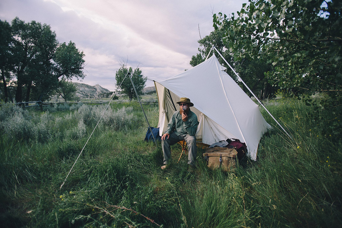
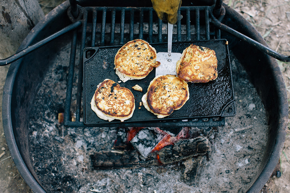
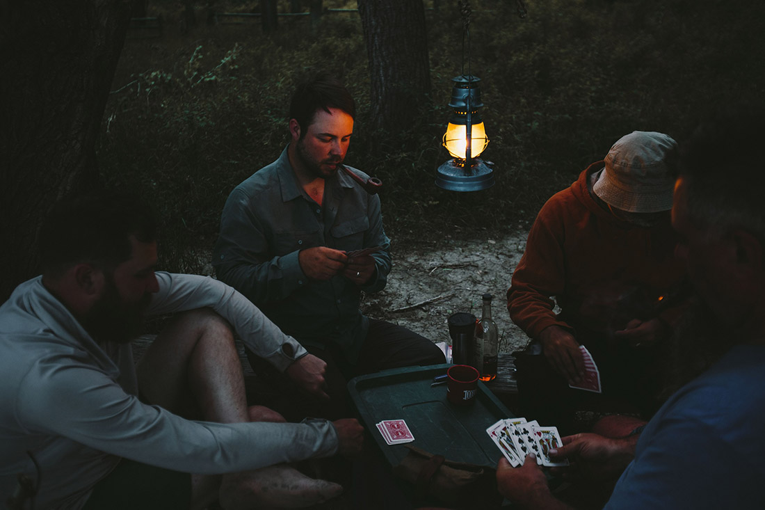
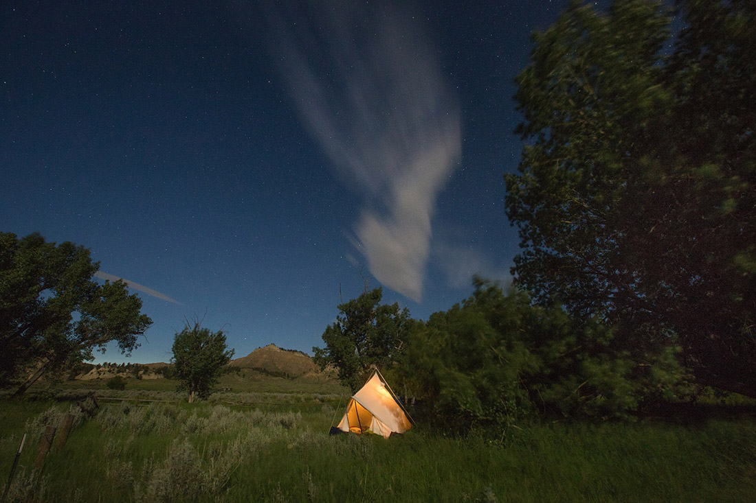
The stand of cottonwoods at Eagle Creek would be our home for the night. We set up camp as the sun set between a crack in the cliffs on the opposite side of the river. Steaks seared over the fire were our dinner. After dinner, we blew around some smoke of both the pipe tobacco sort and the tall tale variety and went to bed fat and happy.
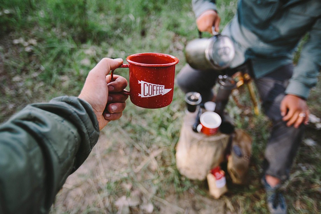
We woke early but broke camp slowly. Shakshouka for breakfast is an experience to savor. It’s a savory North African dish of eggs poached in a tomato stew that’s become a staple for us on recent trips, providing proof that camping doesn’t have to be minimalistic. It can be an experience worth working for.
Instead of hitting the water right away, we decided to go for a hike up Neat Coulee which drains vast rolling farmland within eyeshot of the Bear’s Paw Mountains. Leaving the cottonwoods behind, we stepped heavily through sagebrush, hoping to scare off any unseen rattlesnakes. The creek bed we followed led through a gorge with sides that grew steadily steeper and tighter until we were shimmying through a shoulder width ravine. The canyon climbed upwards until the only way to continue was scrambling over loose sand and rock. In the end, the view was worth every drop of sweat. We sat in the shade of a stone arch looking proudly back down the gully we’d climbed. The view, as gratifying as it was, served as a reminder that to reach our goal 100+ miles down river, we needed to spend several hours every day making progress. The morning was now gone so we hiked back to our canoes and hit the water.
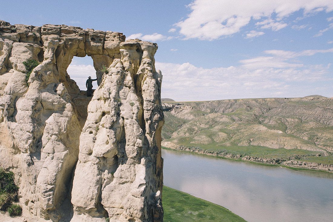
The next several days were spent mostly on the water, but at one point we pulled off for a break from paddling and another hike. This time at a spot aptly named Hole in the Wall. Here, a cliff face reaches hundreds of feet above the water and near the top, a window opens through the rock. A steady climb along a narrow path through cattle pastures leads upward toward the brim of the river valley. Through that stone window you can see the river stretching for miles in either direction. Hidden from view at water level is a gallery of statues and columns. Among those stone figures high above the water, a person is reminded of their smallness.
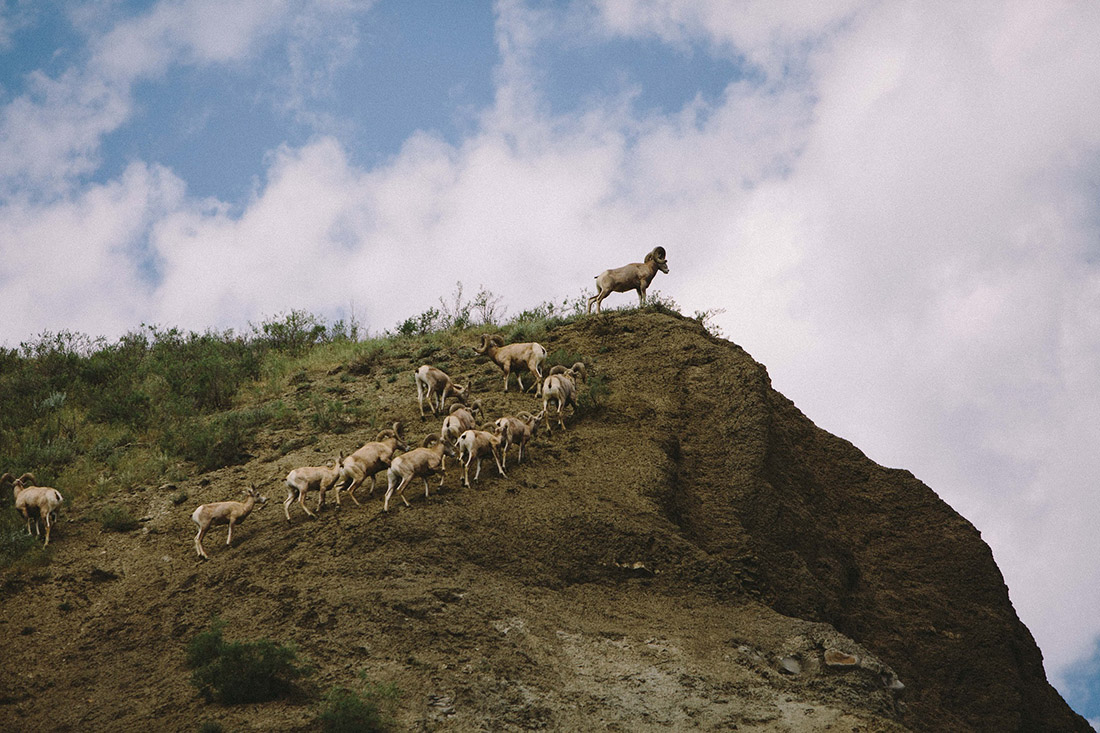
After several days of paddling, we reached Judith Landing near Judith Creek, spot named by William Clark on his journey west. He thought the area to be particularly clear and pretty which reminded him of a girl back home he hoped to marry someday. South of Judith, the landscape changed. The white cliffs, volcanic spires, and stone figures were behind us. They were replaced by sandy hills reminiscent of the Badlands. While the landscape wasn’t as striking, we were fortunate to see groups of bighorn sheep on multiple occasions.
It was in this stretch downriver from Judith where we saw several abandoned homesteads. We camped for two nights at the Gist family homestead. The home itself was unremarkable apart from the story it hinted at. We walked around the sagging wood structures and imagined what was. From the Gist home you could see for miles up and down river. I’ve seen few sunsets quite like the one we experienced here. Brilliant orange changing to red to purple to a deep blue. Every moment I thought, this is the best I’ve seen, and then it got better. Our group took perhaps hundreds of photos yet I’m certain not one did it any sort of justice.
Our last day on the water was a short one. Just a few miles to the landing at Kipp. I spent the day in a Merrimack Tennessean paddling slowly and alone, taking in the last hours on the river. I could have kept up with the group with ease as the boat handled beautifully, but chose solitude instead. Using the Canadian J-stroke, the paddle scarcely came out of the water at all for miles. In the resulting quiet the wildlife around barely took notice of the canoe floating past. A fox wandered past unaware and a goldfinch landed on the bow of my boat. This was the perfect setting for reflecting on the experiences we’d had in the Missouri River Breaks.
Even before our journey was through, plans were already being laid to return. We said to each other, “You know who would love this place?” As the list grew we realized the answer. Everyone.
PHOTOS BY: Graeme Owsianski, Chris Chapman, Peter Boysen & Mark Boysen


No Comments